Bear Mountain Lookout Story:
So you like the postcard/greeting card, do ya’? Let’s get your prepped for an adventure to the Bear Mountain Lookout.
WHAT YOU’LL SEE:
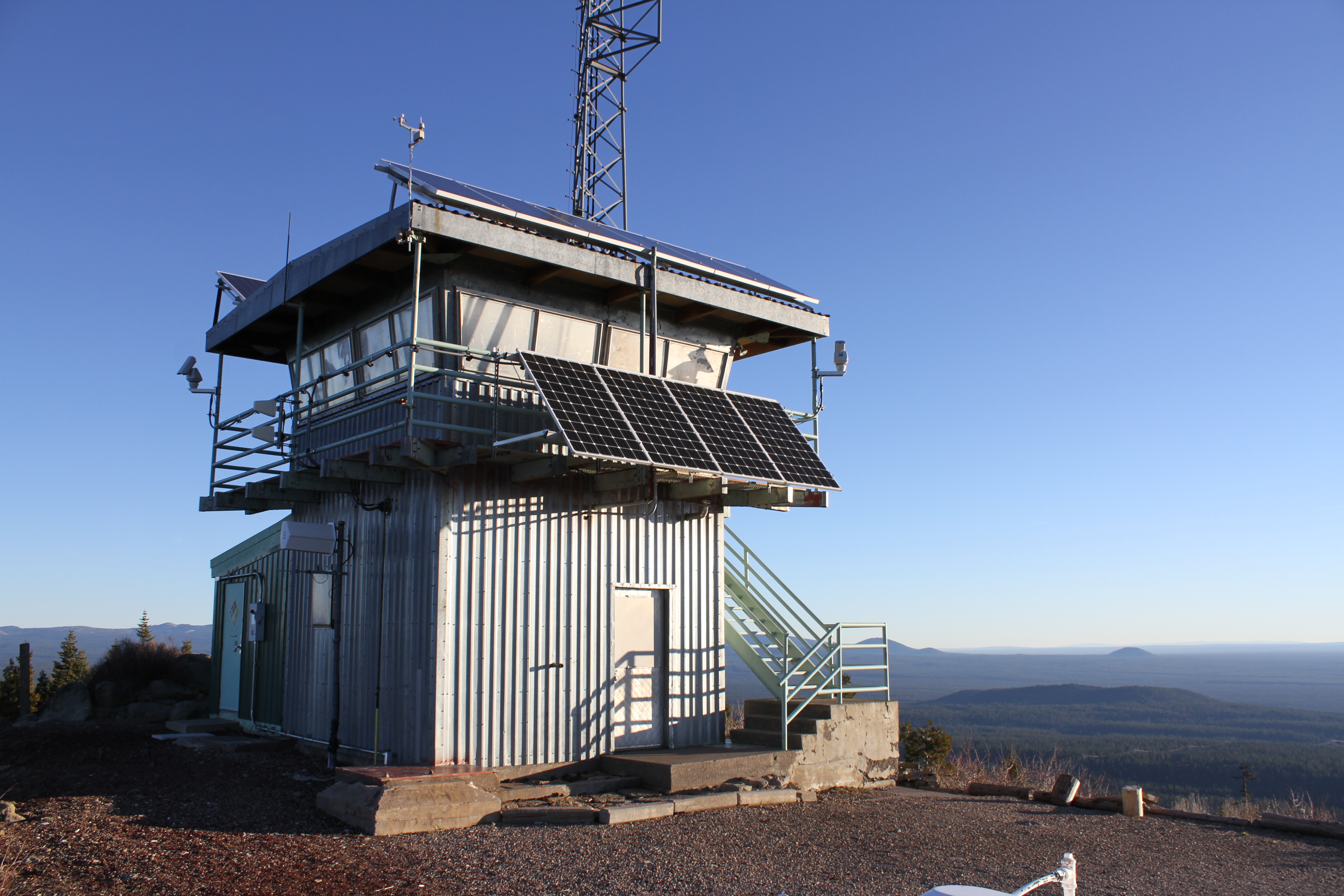
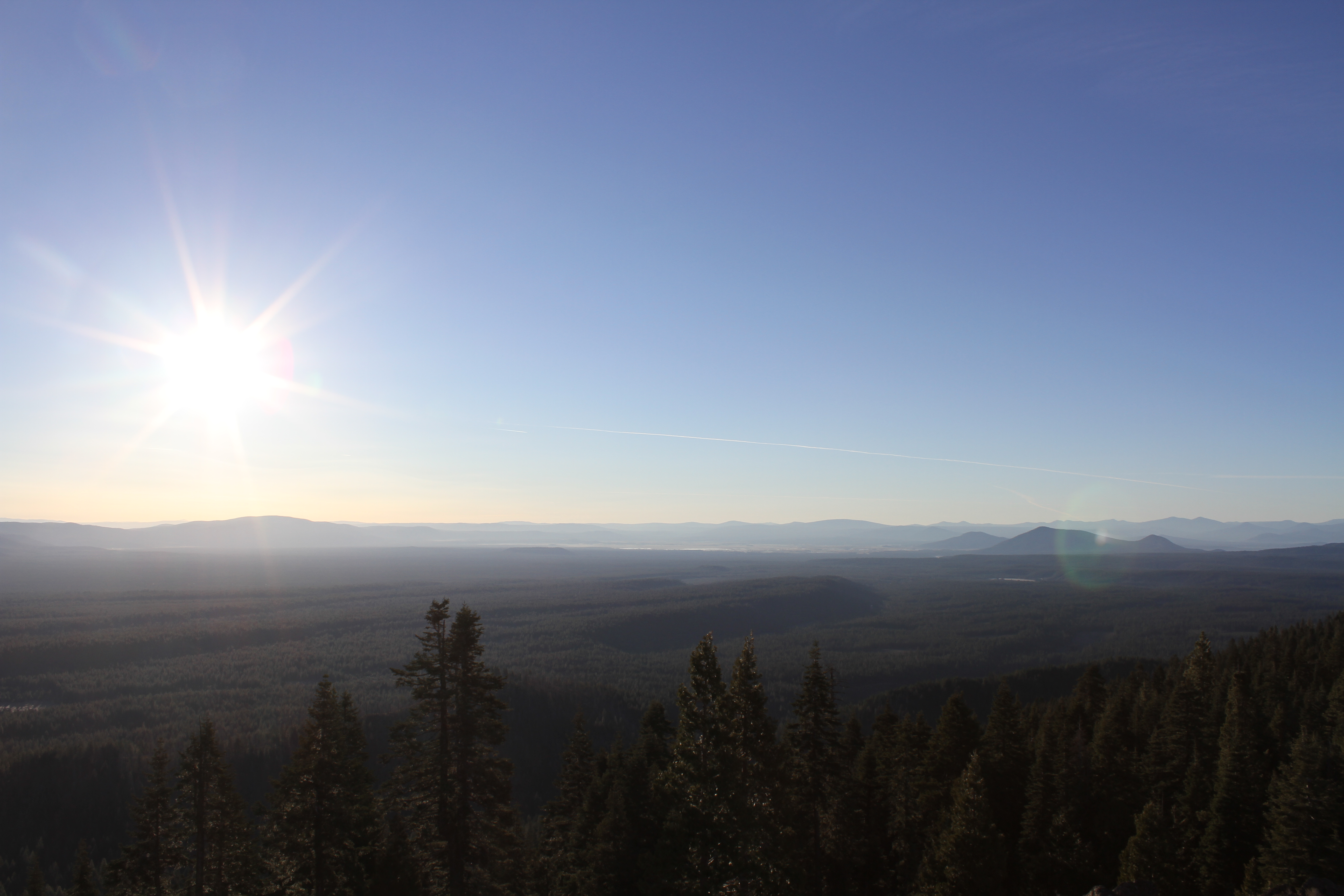
- Mount Shasta, Castle Crags, Fall River/MacArthur California (big Lake) Adjumawi State Park, Mount Lassen, Soldier Peak, the mountains surrounding Medicine Lake, & a really cool fire lookout tower at the top. An unhindered view from the top of a mountain.

THINGS TO KNOW:
- You may have a 1 mile hike ahead of you. There is a yellow gate that blocks the road up to the lookout tower. It’s a 1 mile hike to get up there (gradual incline & actually a nice hike). That gate may be unlocked during the day in the summer. Check with the McCloud Ranger District on the details. If you park at the gate, be sure to pull off to the side of the road so a ranger can drive passed you.

- Best Photos are in the morning right as or just after the sun has risen.
- Winter & Early Spring may have some snowy conditions or a tree across the roads. Not recommended unless you’re well prepared or instead would rather hike/snowshoe to the top. I recommend calling the Forest Service McCloud Ranger Station at 530.964.2184 during regular business hours to check conditions on whether the roads are accessible to the lookout. Deciding whether to go or not? Check the conditions. If it’s clear (no weather, no snow, then it’s well worth the trip). In the winter there’s possibility of trees across the road that can block your travel.
- Maps: Note that there is limited cell coverage in the area. Verizon works intermittently.
- Download the Shasta Trinity Map for Free at the Forest Service’s link: (31 MB) http://www.fs.usda.gov/Internet/FSE_DOCUMENTS/stelprdb5372457.pdf
- Buy the Shasta-Trinity Map @ any Northern California USDA Forest Service Ranger Station.
- Buy the map online ($10) : http://www.nationalforestmapstore.com/product-p/ca-14.htm
- The closest Gas Station is in McCloud.
DIRECTIONS:
(EASY) Easiest way to get here is via a smartphone with GPS: Go to your mapping app, type in 41.301640, -121.719074 and navigate to this point from your nearest location.
(MODERATE) Starting in Mount Shasta City, California. Travel approximately 12 Miles South on Highway 89 towards the town of McCloud. You will drive through the town of McCloud, continue a good distance (approximately 16 miles) and you will pass a small 2-3 building town called the Bartle (remember that if you get hungry). Just beyond Bartle (200 yards or so), take an immediate left on the Harris Spring Road (follow sign toward Medicine Lake). Travel 4.1 Miles and make a right on a road following the signs towards Medicine Lake. Drive a very short distance (1/4 mile) and make a right, following the sign that points to Bear Mountain Lookout. Shortly after being on that road, the road forks. Follow the fork to the left on a forest service road called 40N08 (you’ll see a brown vertical post with this designation on it). Continue driving down this road (the main road from here on out will lead to the bear mountain lookout ). The road will eventually start going uphill. Follow this.
VISUAL DIRECTIONS:

Drive slow and watch out for rocks/branches/trees fallen in the road.
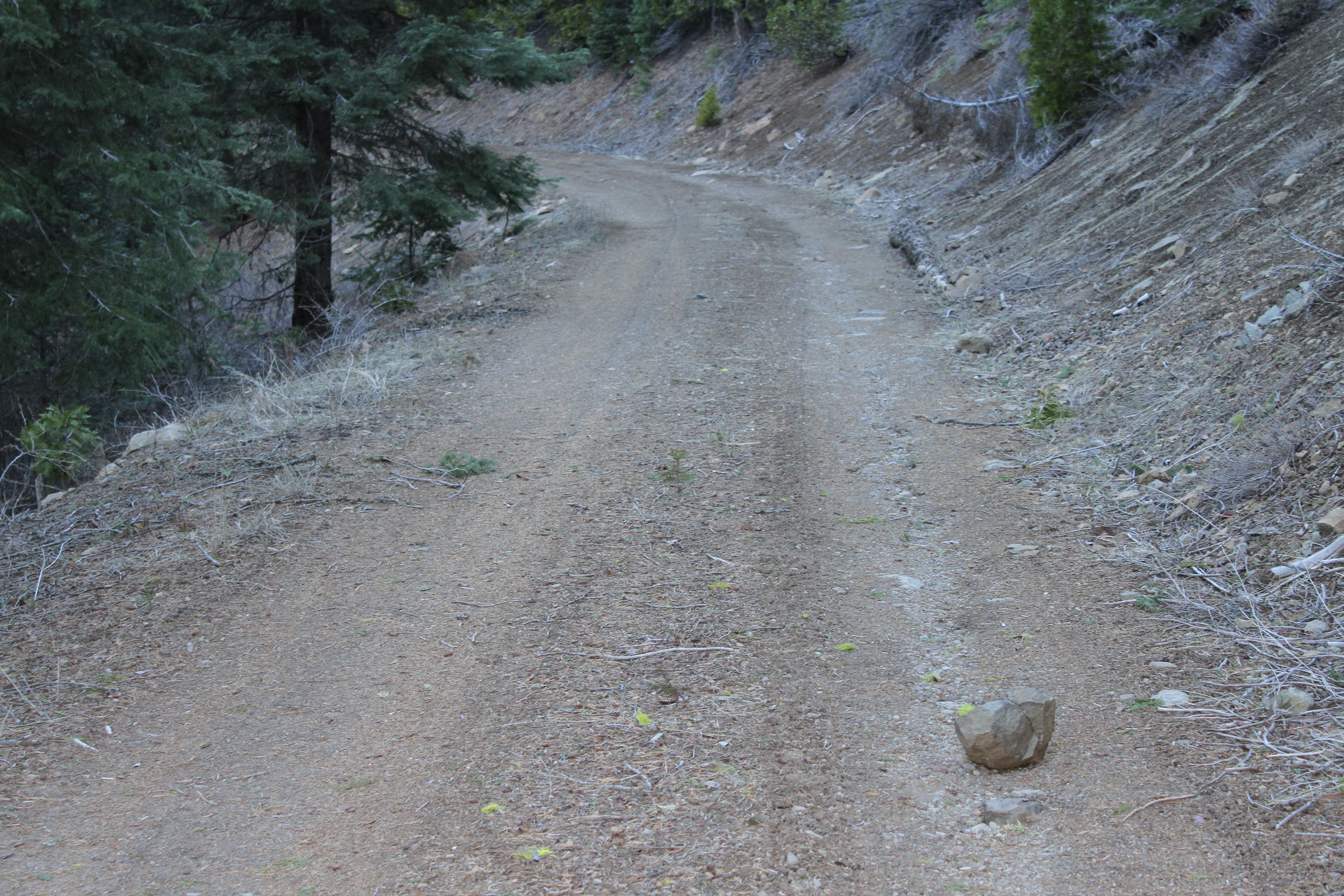 Example of a rock in the road
There is an unmarked road (hard left turn uphill) that goes up to the fire lookout. Look for the blue spray paint on the tree with an arrow (“LO”). That road will lead you up to the top.
HUNGRY:
Remember that tiny building & the town of Bartle (2-3 buildings & a payphone). 16732 California 89, McCloud, CA 96057 or GPS Coordinates (41.256843, -121.834513). Well, if you’re there and they are serving food, they have a legendary potato pancake (if Linda is still working there). It looks a lot like a pancake, but with delicious ingredients inside. I kid you not, the last time I stopped in there, the guy next to me ate it and said he would get in trouble with his wife for not bringing her with him. A few minutes later, a guy walks in with his grandson, sits and tells the kid he’s going to have the potato pancake.
